
A Rare Opportunity On The Lower Dolores River

Dolores River boat ramp at Bedrock, Colorado
Ah the mighty Dolores River.
(This article was written during the big 2019 snow runoff year)
Perhaps our most cherished, most beloved river of the San Juan Mountains. What makes her so special? Read on!
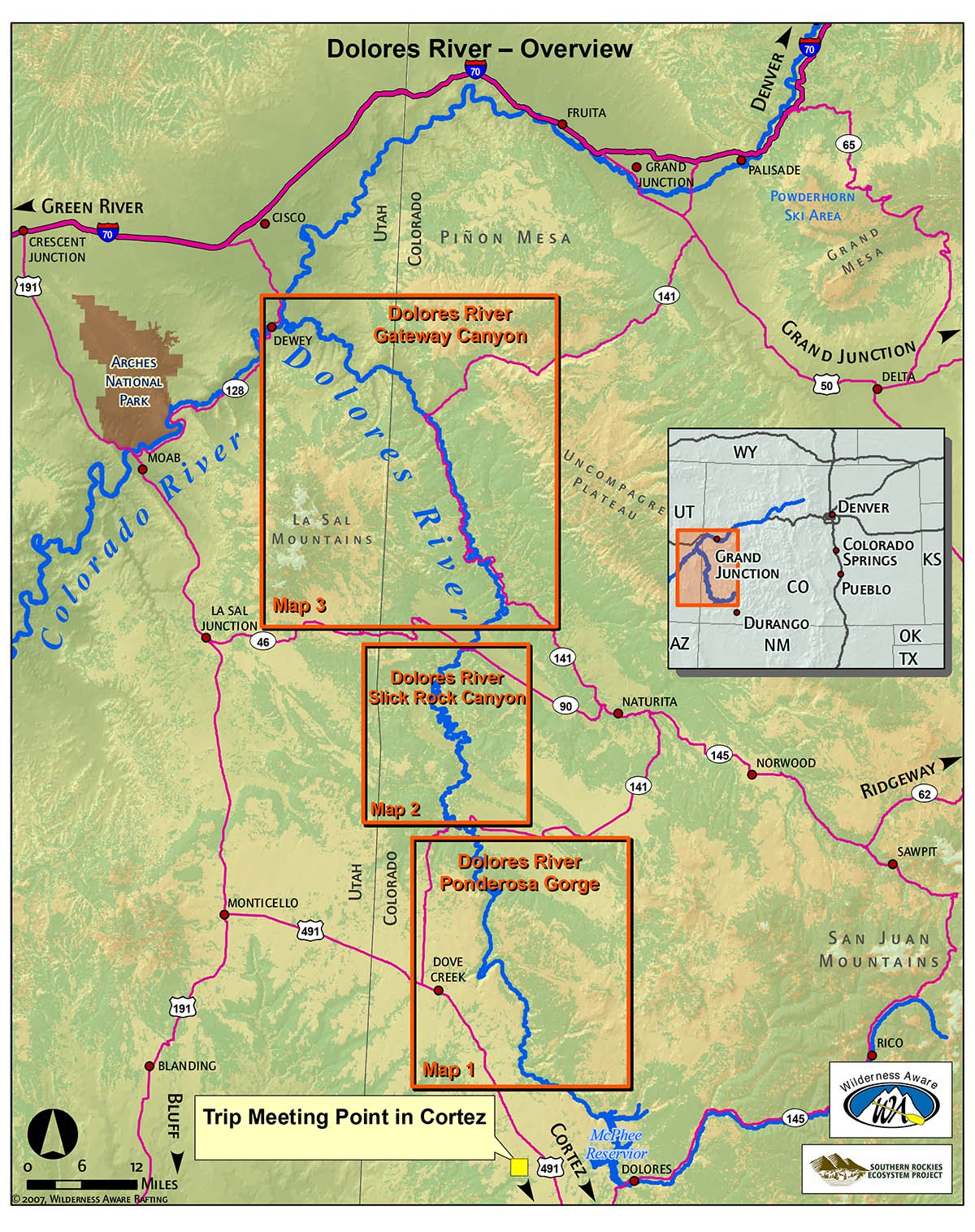
Dolores River map. Photo courtesy of inaraft.com
She begins her journey in the San Juan Mountains atop Lizard Head Pass, flows south towards Cortez where she dumps into Colorado’s second largest reservoir, McPhee Reservoir. From there she takes a hard right and flows north until she meets up with the San Miguel River between Naturita and Gateway where she’s then off to join forces with the Colorado River near Moab.
The Dolores River’s story is a challenging one.
It’s a battle between man and nature, in which man usually wins.
Most years, the Dolores rarely gets a chance to flow below McPhee Reservoir because her water is under severe pressure from the “use it or loose it” mentality of Colorado’s water rights. All of the Dolores’s water is allocated primarily to agriculture and gets divvied up and shipped across the Four Corners and the San Juan River basin.

McPhee Reservoir dam. Photo courtesy of The Durango Herald
In years where the southern San Juan Mountain snowpack hits well over 100% above average, the reservoir fills, ranchers have more water than they can use and the excess water gets released from the reservoir. The last release was two years ago, and fortunately, even after last years disastrous drought, this year is looking to be one of those years!
What makes the Lower Dolores River even more special this year?
For the first time in who knows how long, the Lower Dolores ran all on her own, not at the hands of man, not from snow that landed high up in the San Juans, but from the snow that fell on her surrounding mesas.
And she’s been flowing all in her own for nearly a month at boatable levels similar to what gets released from McPhee Reservoir!

Self-supported stand up paddle board river trip on the Lower Dolores through Slickrock Canyon near Bedrock, Colorado.

Camp at The Grotto in Slickrock Canyon on the Lower Dolores.
We were lucky enough to score a chance to hop on the Dolores for a self-supported SUP trip through her Slickrock section, from Big Gypsum Valley to Bedrock, Colorado, as her natural flows began to taper off!
Keep your eyes peeled to the news. McPhee Reservoir is filling at around two feet per day and is expected to release excess water in early June! Check out the Dolores River Boating Advocates website for updates!
Don’t worry folks, the fun’s not over!
Really? How much more lucky can we get? A whole lot more! The Lower Dolores River between its confluence with the San Miguel River to Gateway and on to the Colorado will be floatable all summer long due to the massive amount of water that will be coming down the San Miguel from the mountains surrounding Lizard Head Pass and Telluride! During big winter years, we can expect both the San Miguel and Lower Dolores rivers (below the confluence) to be floatable till at least mid-July, if not into early August with a good monsoon rain season!
—> For beta, questions or more information on boating the Dolores River, please join the Facebook group Dolores River Paddlers and Rafters! <—
The “Hanging Flume” Section

On our Hala Gear stand up paddle boards on the Dolores River below the Hanging Flume near the old mining town of Uravan, Colorado.
One of the best day floats in Colorado’s West End (especially for paddle boarding) is the “Hanging Flume”. This section consist of one main section, the Hanging Flume itself, with additional miles that can be added on, both from the San Miguel River and Dolores (when she’s flowing) rivers.
For the main “Flume” section, put on at the confluence with the San Miguel River on Y11 Road and take out five miles downstream at the R13 Road bridge where the Rimrocker Trail crosses the Dolores River a.k.a. “Biscuit Rock”. If it’s more action and whitewater excitement you’re looking for, put in on the San Miguel at the new Ball Park Campground at the old townsite of Uravan and float to the confluence or “Biscuit Rock.” For a good long day float, put on at Bedrock and float 11 miles to the confluence with the San Miguel or to “Biscuit Rock.” (Note: Bedrock to the confluence with the San Miguel is only floatable when the Dolores is flowing naturally or from dam release.)